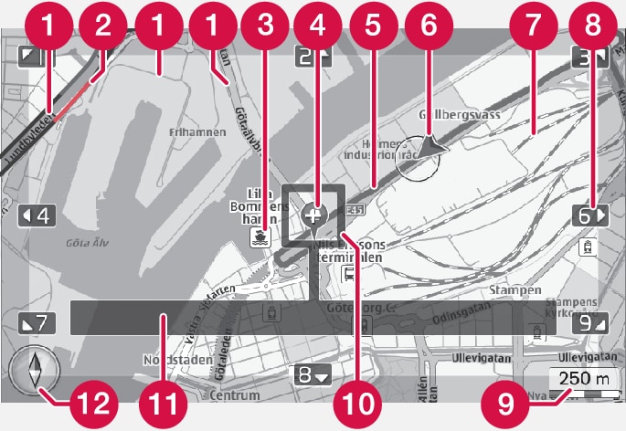
 | Road types - size and colour vary depending on the size of the road and the selected map scale and map colour |
 | Traffic information - highlighted with a line in the edge of the road. |
 | Points of interest (POI) |
 | Symbol for destination/final destination |
 | Planned route - blue |
 | The car's current position |
 | Railway |
 | Scrolls/moves the map in the direction of the arrow using the corresponding number on the numerical keyboard |
 | Map scale |
 | Focus box with crosshair in the centre |
 | Current road/street name or coordinates or information about point of interest (POI) |
 | Compass |