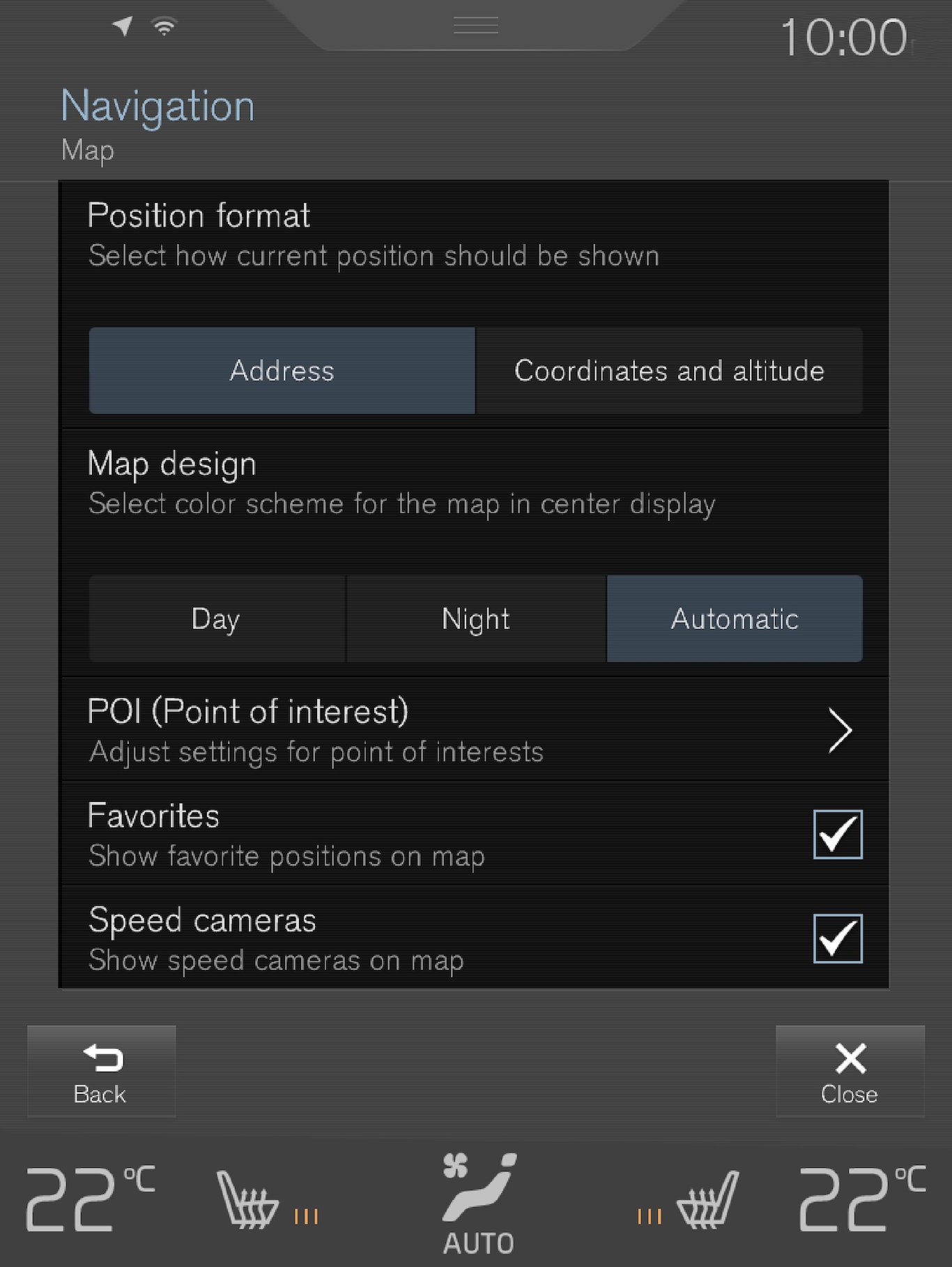
Settings can be made within the following areas:
- Position Format
- Map Design
- POI
- Favourites
- Speed Cameras1
Position format
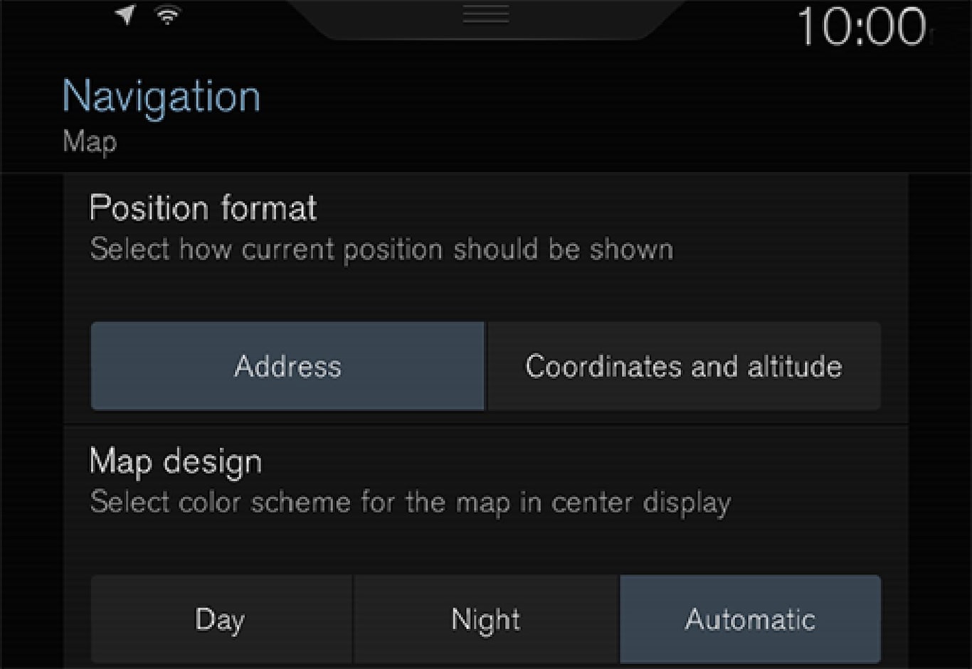
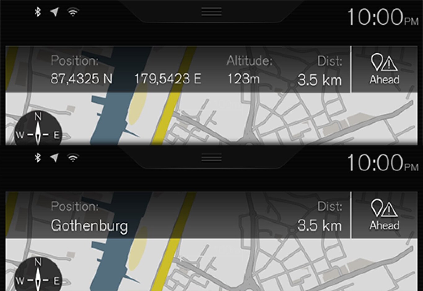
Position Format is used to choose whether the current position should be named/shown with its address or its coordinates:
- Address
- Coordinates and altitude
The following illustration shows both of the alternatives.
Map design
Map Design is used to choose how the map's colours should be shown:
- Day - bright colours.
- Night - dark colours so as not to interfere with night vision.
- Auto - The system switches between Day and Night according to the light in the passenger compartment.
POI
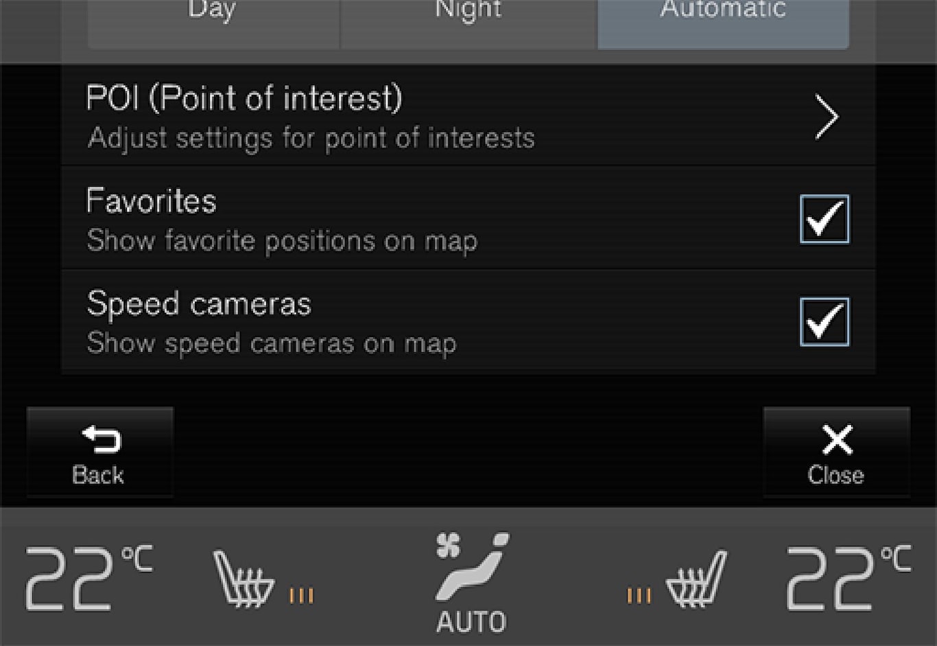
Select here which POIs should appear on the map. Every category has two alternatives - either select that all POIs in a category are to be shown, e.g. "Transport services".
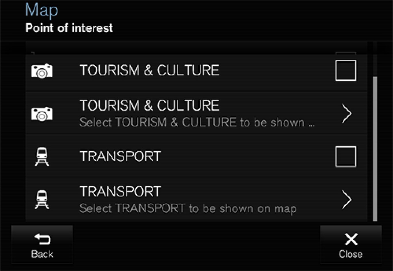
Or open the category with the ">" symbol and then select which subcategories shall or shall not be shown.
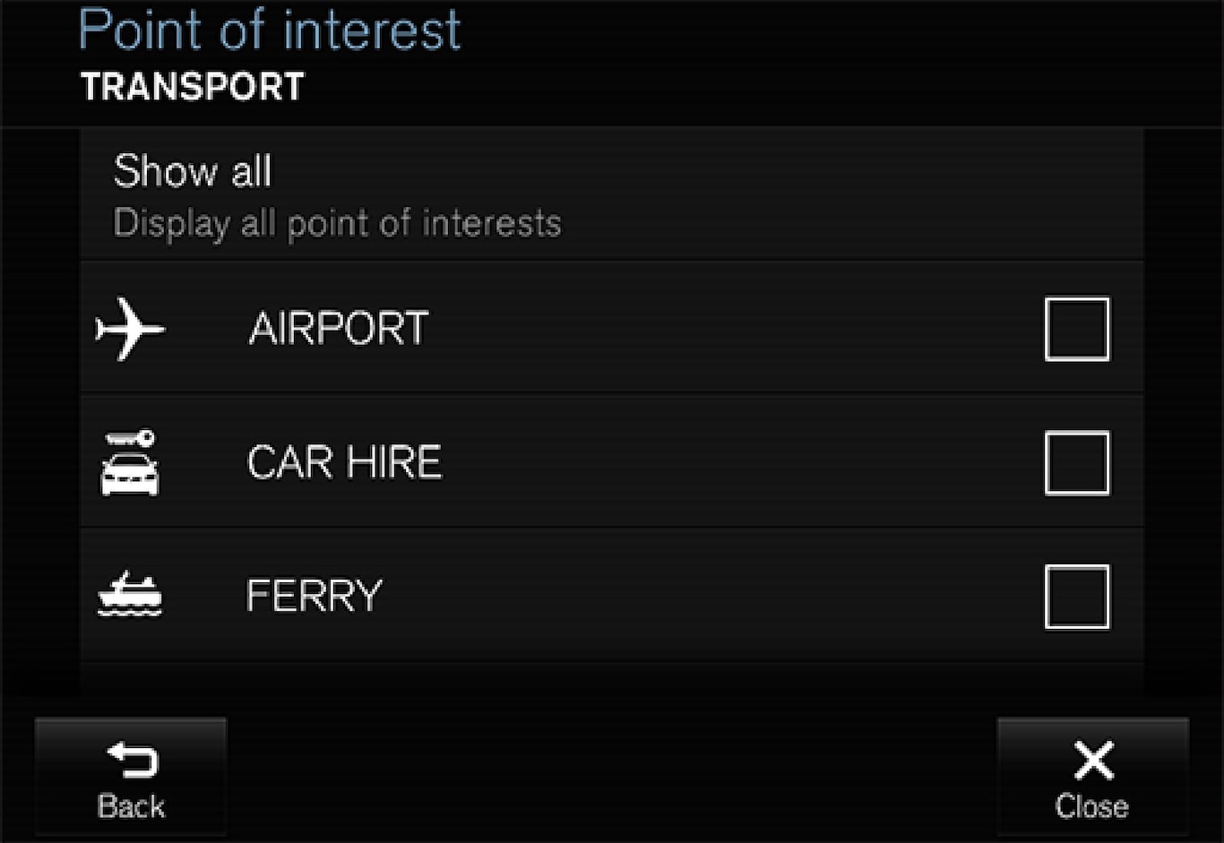
- Highlight the POI categories which should be shown on the map and exit the menu by tapping on Back or Close.
For more information see "Specify destination with a POI".
Favourites
Choose whether or not Favourites shall be shown on the map:
- Yes/No
For more information see the section "Specify destination with Latest/Favourites/Library".
Speed cameras1
Choose whether or not Speed Cameras shall be shown on the map:
- Yes/No