Navigation* - traffic information

The navigation system continuously receives traffic information transmitted via Traffic Message Channel (TMC) which is used for dynamic road directions. When situations that can affect the journey occur (e.g. accidents, road works) this is shown on the screen, and when a destination has been specified there is a recalculation of the route. Recalculation can take place automatically or require confirmation, see Reroute on request.

TMC is a standardised coding system for traffic information. The receiver automatically searches for the correct frequency.

 Note

TMC is not available in all areas/countries. The system's coverage area is under constant construction and updating may sometimes be necessary.

The traffic information is presented differently depending on whether the destination is specified or not specified.

P3-1346-NAV-Melco Trafiksymbol TMC

This symbol on the screen indicates that traffic information is available within the current reception area. Symbol colour indicates the importance of the information:

  • RED - the information is read out and the position is shown on the map.
  • YELLOW - no reading out, the position is shown on the map.
P3-1346-NAV-Melco Trafiksymbol Prblm-position

This symbol marks the position of a traffic problem, for more information, see section Traffic information - with specified destination > Traffic information on map.

 Note

Traffic information is not available in all areas/countries.

The traffic information transmission areas are constantly being expanded.

Traffic information - without specified destination

The function allows you to show traffic problems without the destination having been selected.
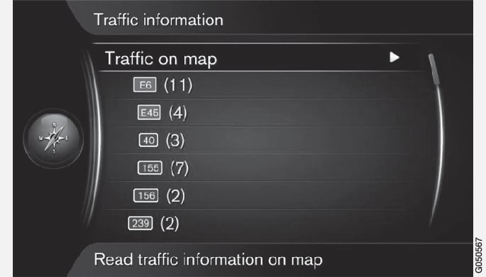
P3-1346-NAV-Melco Meny Trafinfo Trafik på kartan-UTAN rutt
Opens the scroll function on the map.

Traffic information on map

In the normal view for the navigation source, press OK/MENU and select Traffic informationTraffic on map.
Search for traffic problems with the scroll function, see description below in the section Traffic information - with specified destination > Traffic information on map.

All traffic

In the normal view for the navigation source, press OK/MENU and select Traffic informationTraffic on map.
A list of all traffic messages within the reception area is shown.
Select what should be shown, see description below in the section Traffic information - with specified destination > All traffic.

Traffic information - with specified destination

The function shows traffic problems when the destination has been entered.
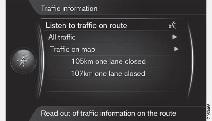
P3-1346-NAV-Melco Meny Trafinfo Lyssna på trafikinfo

Listening to traffic information along the route

In the normal view for the navigation source, press OK/MENU and select Traffic informationListen to traffic on route.
Current traffic messages along the itinerary will be read out.

All traffic

In the normal view for the navigation source, press OK/MENU and select Traffic informationAll traffic.
A list of all traffic messages within the reception area is shown. Traffic information is first grouped according to country (in border areas), then road number and then street name.
Select a traffic problem (road/street) and confirm with OK/MENU.
Traffic problems are listed, with the most serious disruption at the top, e.g. total stop in a lane.
Select a traffic problem and confirm with OK/MENU.

Additional information about the traffic problem is shown, as well as position on map. The map image is centred around the position of the traffic problem.
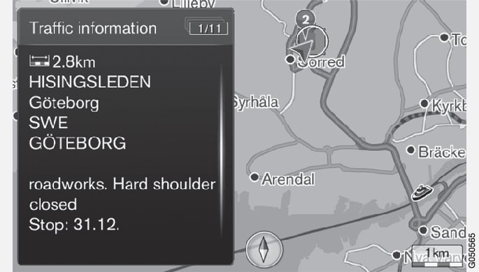
P3-1346-NAV-Melco Meny Trafinfo All trafik-4
Traffic problem on map.

Traffic information on map

In the normal view for the navigation source, press OK/MENU and select Traffic informationTraffic on map.
Scroll the map until the traffic event/symbol for which detailed information is required is positioned in the crosshair.
A yellow frame around the symbol is lit.
Confirm the selection by pressing OK/MENU

Available information is shown, e.g.

  • street name/road number
  • country
  • nature of the problem
  • extent of the problem
  • duration of the problem.

If there are several traffic problems within the crosshair frame then the one closest to the centre of the crosshair is shown first.

Figures such as "2/5" in the upper part of the screen mean that the information shown is number 2 of a total of 5 messages within the crosshair - remaining messages are browsed to using repeated short presses on OK/MENU.

Direct listed information
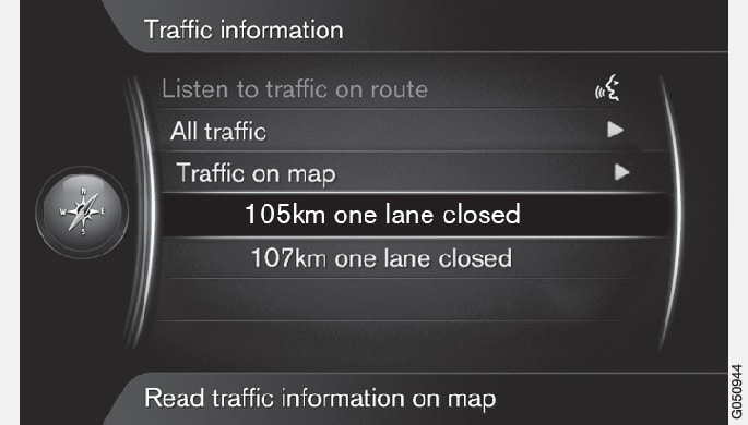
Px-1420-NAV-Melco Meny Trafinfo Trafik på kartan-2
In the normal view for the navigation source, press OK/MENU and select Traffic informationTraffic on map.
Direct listed traffic problems (two in the previous illustration) indicate that the information affects the current itinerary.
Select a traffic problem and confirm with OK/MENU.

Additional information about the traffic problem is shown, as well as position on map. The map image is centred around the position of the traffic problem.

P3-1346-NAV-Melco Meny Trafinfo All trafik-4
Traffic problem on map.

Extent of traffic problem

Certain traffic problems are not just tied to one single position, but can cover a longer section.

In addition to the symbol for the position of the traffic problem, the current distance is also highlighted with a row of red crosses "xxxxx".

  • The length of the highlighting corresponds to the extent (distance) of the traffic problem.
  • Driving direction is indicated by the side of the road that is highlighted.
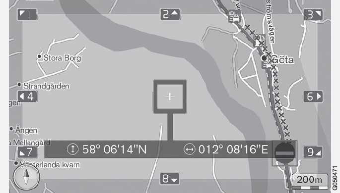
P3-1346-NAV-Melco Meny Trafinformation Trafik på kartan-4
Traffic problem with its extent.

Size of area for traffic information

The map scale determines how much traffic information can be shown. The larger the map area that is shown on the screen, the greater the number of traffic disruptions that can be shown.

  1. * Option/accessory.