Road types
- Motorway (orange)
- Primary road (dark grey)
- Smaller primary road (grey)
- Ordinary road (light grey)
- Local road (white)
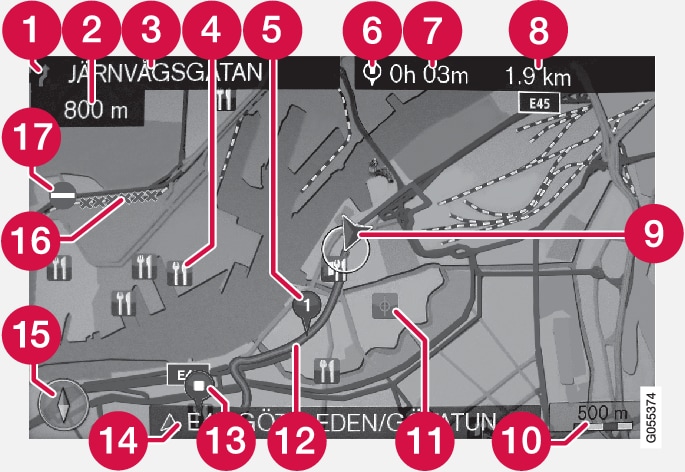
| Text and symbols on screen | |
 | Event at next guidance point |
 | Distance to next guidance point |
 | Name of next road/street |
 | Facility/point of interest (POI) |
 | Planned route waypoint |
 | Symbol for destination/final destination |
 | Calculated arrival time at final destination |
 | Calculated remaining distance to destination |
 | The car's current position |
 | Map scale |
 | Stored location |
 | Planned route |
 | Planned route final destination |
 | Current road/street name - at car's current position (9) |
 | Compass |
 | Section covered by traffic information |
 | Traffic information |