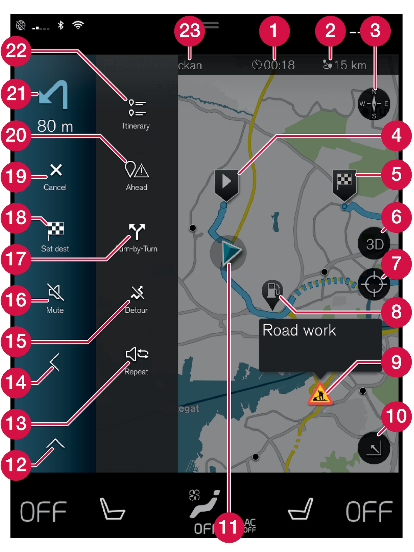
| Symbols and buttons on the map | |
 | Arrival time/remaining travel time |
 | Distance to destination |
 | Compass/changes between north and travel direction up |
 | Starting |
 | Destination/final destination |
 | Changes map display between 2D and 3D |
 | Reset the map to follow the car |
 | Point of interest (POI1) |
 | Traffic information |
 | Minimises (expanded view) or maximises the map image (full screen) |
 | Car on planned route |
 | Minimises the tools field |
 | Repeat the current voice guidance |
 | Minimises the tools field |
 | Calculate detour |
 | Voice guidance temporarily On/Off |
 | Shows list with the itinerary's guidance points |
 | Specifying destinations/intermediate destinations |
 | Cancels guidance |
 | Shows list of the itinerary's points of interest (POI1) and traffic information |
 | Next manoeuvre |
 | Itinerary and Alternative route |
 | Destination/final destination |