Vejtyper
- Motorvej (orange)
- Hovedvej (mørkegrå)
- Mindre hovedvej (grå)
- Almindelig vej (lysegrå)
- Lokalvej (hvid)
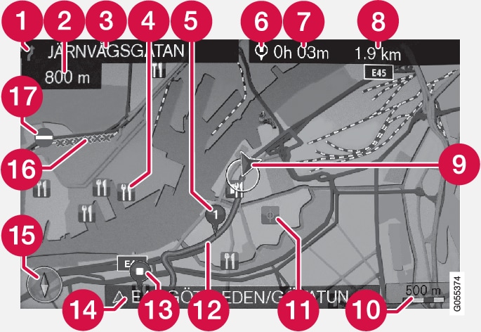
| Tekst og symboler på skærmen | |
 | Problem ved næste vejvisningspunkt |
 | Afstand til næste vejvisningspunkt |
 | Navn på næste vej/gade |
 | Facilitet/interessepunkt (POI) |
 | Planlagt rutes mellempunkt |
 | Symbol for destination/slutdestination |
 | Forventet ankomsttidspunkt til slutdestination |
 | Anslået resterende strækning til destinationen |
 | Bilens aktuelle position |
 | Målestok |
 | Gemt sted |
 | Planlagt rute |
 | Planlagt rutes slutdestination |
 | Aktuelt vej-/gadenavn – ved bilens aktuelle position (9) |
 | Kompas |
 | Vejstrækning berørt af trafikinformation |
 | Trafikinformation |