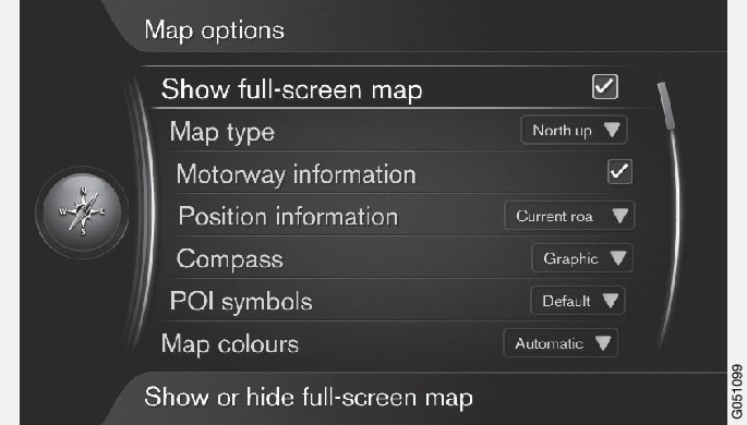
Full-screen map
In the navigation system's normal view, press the thumb wheel/OK/MENU and select .
Choose a size:
- Checked box: the map will be displayed over the entire screen.
- Empty box: other information, such as a track being played on the infotainment system and passenger compartment temperature will still be displayed on the upper and lower sections of the screen respectively.
Map type
In the navigation system's normal view, press the thumb wheel/OK/MENU and select .
Select how the map is to be displayed on the screen:
- North up: the map will always have north at the top of the screen. The "vehicle" symbol will move in the current direction on the screen.
- Map heading up: the "vehicle" symbol will be at the center of the map and will always point upward. The map will rotate under the symbol, depending on the direction of the road.
- 3D map basic: the map will be displayed at an angle from above and the "vehicle" symbol will be at the center of the map and will always point upward.
- 3D map enhanced: the same as 3D map basic but with objects such as buildings, etc. displayed on the map.
Highway information
In the navigation system's normal view, press the thumb wheel/OK/MENU and select .
Select a function:
- Checked box: If you are driving on a highway, the next 3 exits will be displayed, e.g., exits where there are rest areas or gas stations. The list is sorted so that the nearest exit is at the bottom of the list.
- Empty box: the function is deactivated.
Information about the current location
In the navigation system's normal view, press the thumb wheel/OK/MENU and select .
Select the type of information to be displayed:
- Current road: the name of the road where you are driving/cursor is pointing is displayed.
- Lat/Long: the location's co-ordinates where you are driving/cursor is pointing is displayed.
- None: No information will be displayed.
Compass
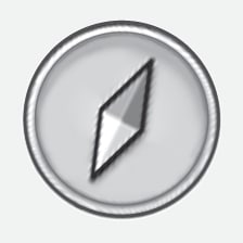
The direction in which you are driving will displayed as a compass pointer or with letters.


The compass needle's red pointer points to the north. A text-based compass can also be selected.
In the navigation system's normal view, press the thumb wheel/OK/MENU and select .
Select to display the compass needle or letters:
- Graphic: a compass needle symbol indicates the compass heading.
- Text: the letters N (north), W (west), S (south) or E (east) indicate the compass heading.
Set the map orientation (north or direction toward the top of the screen). See also the previous section "Compass."
Points of interest (POIs) on the map
In the navigation system's normal view, press the thumb wheel/OK/MENU and select .

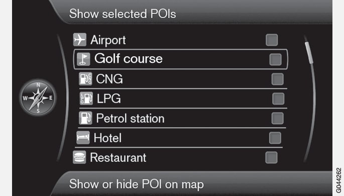
Select the POI symbols to be displayed on the map:
- Default: – POIs chosen using the Selected function will be displayed.
- Selected: Turn the thumb wheel/TUNE to scroll and select each desired POI by pressing the thumb wheel/OK/MENU. The selected POIs will be displayed on the map.
- None: no POIs will be displayed.
In order to make the map easier to read, the number of POIs that are displayed at the same time is limited. Zoom in on an area to display more POIs.
Map colors
In the navigation system's normal view, press the thumb wheel/OK/MENU and select .
Select among the following:
- Automatic: a sensor monitors the ambient lighting conditions and changes map colors automatically.
- Day: colors and contrast are adapted for daylight conditions.
- Night: colors and contrast are adapted for dark conditions.
Stored locations on the map
In the navigation system's normal view, press the thumb wheel/OK/MENU and select .
All stored locations are listed here.